
Updates Entry
April 29, 2013
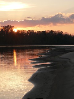
May 14 - Big Muddy Speaker Series - Rocheport 2013
"Location, Location, Location -
How Missouri River geography shapes restoration and management options"
presentation by Robert Jacobson, PhD, Chief of River Studies Branch, US Geological Survey
Tuesday, May 14, 2013
7 p.m. presentation
lower floor of the Les Bourgeois Vineyards Bistro
in Rocheport, MO (directions below)
Presentation is FREE and open to the public! Come early to purchase a great dinner upstairs at the Bistro!
 The past two years of extreme flooding followed by extreme drought in the Missouri River basin highlights the difficulties in managing and restoring this massive river system. Every decision made in Missouri River management seems to have repercussions that affect other uses or stakeholders along the river.
The Missouri River basin ranges over 23 degrees of longitude and 12 degrees of latitude, and in its breadth it encompasses tremendous physiographic, climatic, ecologic, and socio-economic diversity from the snowpack of the Rockies to the arid plains of the Dakotas to the moist river hills of the Ozarks' northern edge.
This diversity promotes challenges to restoration and management. One size of policy does not fit well in all parts of the river. Robert Jacobson, PhD, chief of River Studies for the US Geological Survey, will provide an overview of the environmental geography of the Missouri River and an analysis of how the very location of the river effects restoration and management options along the mainstem from Montana to Missouri.

Dr. Jacobson has been a frequent contributer to the Big Muddy Speaker Series. His presentations always provide a deep and thorough look at the river from a data-based perspective. You will undoubtedly leave this presentation with a lot to think about and solid base of knowledge from which to draw from.
Directions
-
Take I-70 to the Rocheport, MO, exit (Exit #115). It's the first exit east of the Missouri River.
-
Head north toward Rocheport.
-
After about a mile, turn left at the sign for Les Bourgeois Bistro. Follow the signs to the Bistro. You will probably need to park in the lot above the Bistro and walk the trail down.
-
The presentations are held in the lower level. You can either enter at the restaurant entrance then go down the stairs to your left past the bar, or you can follow the walk to the right of the restaurant and enter through a glass door into the lower level.
-
14020 W. Hwy BB, Rocheport, MO (click for Google Map)
The Big Muddy Speaker Series in Rocheport
is hosted by Missouri River Relief, Friends of Big Muddy, the Big Muddy National Fish & Wildlife Refuge and the Columbia Fish & Wildlife Conservation Office (USFWS).
All speakers are presenting for free! Thank you all for sharing your knowledge with us!
Click here for a list of upcoming presentations»
The Big Muddy Speaker Series also takes place monthly in Kansas City and St. Charles.
Resources
- Presentation Flier (pdf)
- Collection of Missouri River publications by USGS River Studies»
- Bio of Robert Jacobson, including list of projects and publications»
- "River Corridor Habitat Dynamics" - overview of USGS Missouri River studies.
- "Flood Risk Determines Wetland Restoration Potential Along Missouri River" - USGS Press Release and study - June 10, 2011
- "Scientist questions flood benefits of public lands along Missouri River" - article in Columbia Missourian (July 5, 2011) describing Jacobson's work studying retention of floodwater by conservation areas.
www.riverrelief.org is created and maintained by Missouri River Relief, P.O. Box 463, Columbia, MO 65205
Copyright © 2024 Missouri River Relief, photos copyright © their respective owners
Site designed and built by Josh Nichols.