
Updates Entry
January 17, 2011
Feb. 8 Big Muddy Speaker Series
"Got Mud?
The Science and Policy of Missouri River sediment"
presented by Robb Jacobson, PhD, Branch Chief of USGS River Studies
and Dave Galat, PhD, Dept. of Fisheries & Wildlife, University of Missouri, Columbia
7:00 p.m. - Tues. Feb. 8, 2010
lower floor of the
Les Bourgeois Vineyards Bistro
in Rocheport, MO
(directions below)
Presentation is FREE!
Come early to purchase a great dinner upstairs at the Bistro!
Click here for flier»
Join us for our monthly Big Muddy Speaker Series at the Les Bourgeois Bistro. What does it mean that the Big Muddy has "too much" or "not enough" sediment? We'll be joined by fluvial geomorphologist Robb Jacobson and river ecologist Dave Galat as they attempt to excavate the many layers of science and policy that make sediment flow in the Missouri River such a complex quagmire.
What could be a more singular issue to the Missouri River than the issue of mud?
Too much above the dams, too little below. Ramps silt in, banks cave in. The Corps robbed the river of sediment, the Corps added too much.
Most of the changes that humans have made to the Missouri River have affected the flow of sediment through the system. Whether you're talking about navigation, fish, birds, water supply, flood control, habitat mitigation or boat motors, chances are the sediment of the river figures in somewhere.
Robb Jacobson and Dave Galat have agreed to give us a tag-team crash course on Missouri River mud. Jacobson is a fluvial geomorphologist, studying the interaction of rivers with the landscape they move through. Of course the Missouri River isn't your average river, and the role sediment plays in the story of the Missouri River is a complex mix. No one is better than Jacobson at clarifying the waters.
Galat will offer another perspective. How do you develop a fair and scientifically balanced policy on what sediment means in the river? What goals do you choose? These are some of the issues Galat had to wrestle with working on a National Academy of Sciences committee report on Missouri River sediment. The report is intended to guide states and federal agencies on resolving differences about mud.
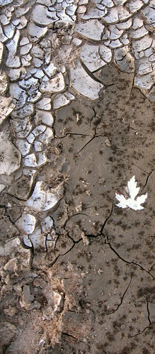
photo copyright Francis Baum, California Island
Directions
- Take I-70 to the Rocheport, MO, exit (Exit #115). It's the first exit east of the Missouri River.
- Head north toward Rocheport.
- After about a mile, turn left at the sign for Les Bourgeois Bistro. Follow the signs to the Bistro. You will probably need to park in the lot above the Bistro and walk the trail down.
- The presentations are held in the lower level. You can either enter
at the restaurant entrance then go down the stairs to your left past the
bar, or you can follow the walk to the right of the restaurant and
enter through a glass door into the lower level.
- 14020 W. Hwy BB, Rocheport, MO (click for Google Map)
www.riverrelief.org is created and maintained by Missouri River Relief, P.O. Box 463, Columbia, MO 65205
Copyright © 2024 Missouri River Relief, photos copyright © their respective owners
Site designed and built by Josh Nichols.